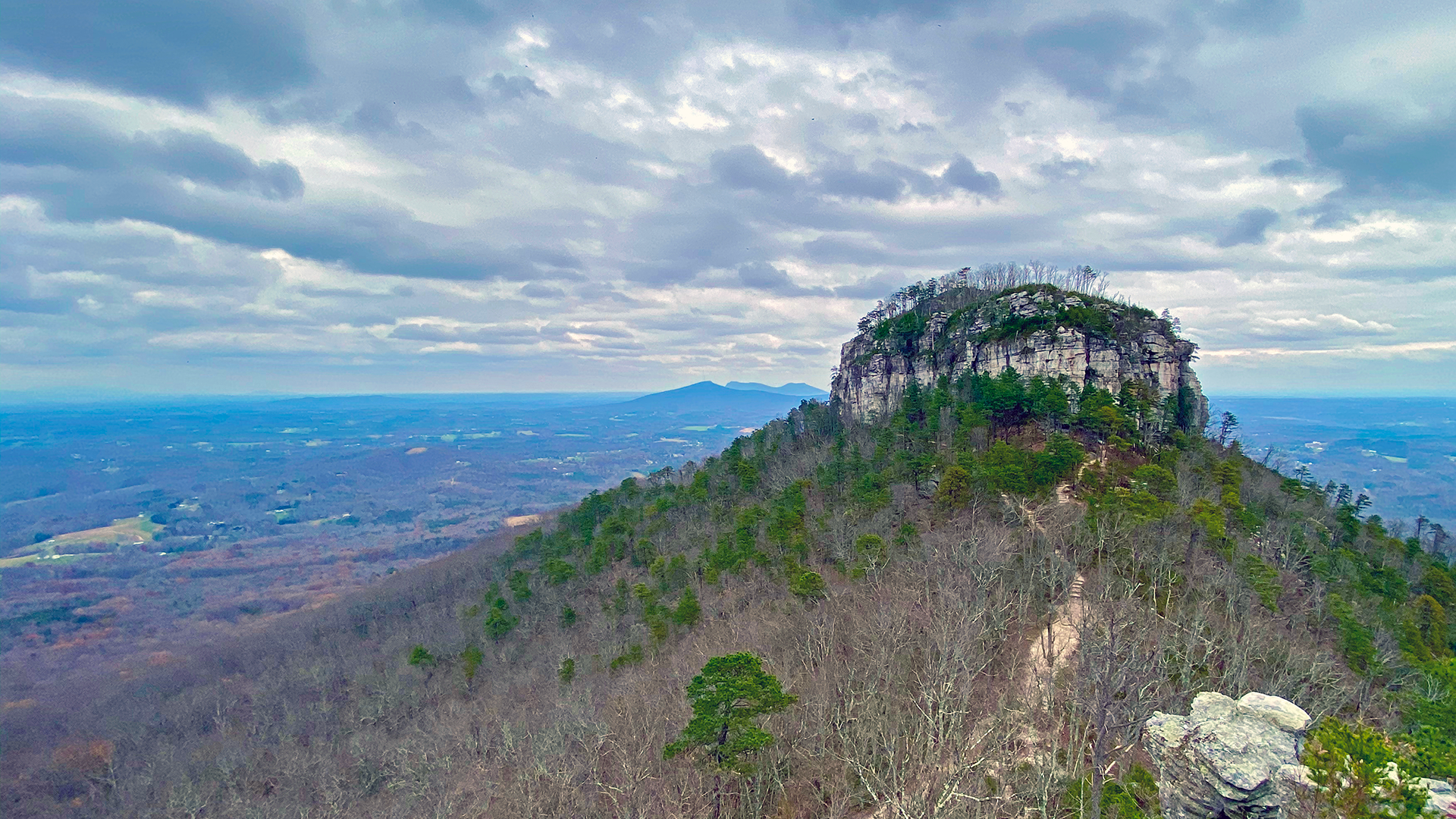

Pilot Mountain is a imposing geological knob in the middle of the Piedmont region of North Carolina and is contained inside of the borders of Pilot Mountain State Park. Along with the neighboring Sauratown mountain range to the east, it forms the so called “mountains away from the mountains” area of the Tar Heel state.
With such features, Pilot Mountain has many mountain overlooks with great views of the surrounding area, including the Blue Ridge Mountains to the Northwest. And the best way to see them all is by hiking the trails of the park.
This post describes a 6-mile, 1180-foot elevation gain day-hike that circumnavigates Pilot Mountain and visits the best overlooks along the trails around the knob.

The interactive map below shows hiking trails to go up and around the mountain, starting from the parking lot of the Visitor Center. Click on the hotspots for a visualization of the views and photos.

 1 Visitor Center 2 3 4 5 6 7 8 9 10
  1 Mountain Trail junction 2 3 4 5 6 7 8 9 10
 1 Mountain Trail 2 3 4 5 6 7 8 9 10
  1 2 3 4 5 6 7 8 9 10 Mountain Trail
  1 Grindstone Trail junction 2 3 4 5 6 7 8 9 10
 1 Three Bears Gulley 2 3 4 5 6 7 8 9 10
  1 Ledge Spring Trail 2 3 4 5 6 7 8 9 10
  1 Ledge Spring trail 2 3 4 5 6 7 8 9 10
 1 Little Pinnacle overlook 2 3 4 5 6 7 8 9 10
  1 Grindstone Trail 2 3 4 5 6 7 8 9 10
 Starting from the Visitor Center, go across the road and then follow the signs to Mountain Trail. Once you get to the trail intersection, you can choose to go either clockwise or in the reverse direction, but the sequence of trails below and in this page’s map will describe how to do it in a clockwise direction.

The sequence of trails in this loop and mountain “summit” were as follows:
- Mountain Trail (red blazes)
- Grindstone Trail towards the summit (blue blazes)
- Ledge Spring Trail (yellow blazes)
- Jomeokee Trail
- Little Pinnacle overlook
- Grindstone Trail back towards the Visitor Center (blue blazes)


This is a great place for a rest and a snack before hitting the trail back down to the Visitor Center.
For a more detailed view of my day hike around Pilot Mountain in November, 2020, here is the GPS data of the activity:
Where to Stay
There are several options of hotels and campgrounds in the area, including the campground in the state park itself which is a great place to stay, however, as of the writing of this post, the campground was closed due to electrical damages to its facilities. As alternatives to that, for campers and RVers I have two recommendations:
- Jomeokee Campground, for tent campers and small trailers. No sewer hookups, but electricity and water hookups are available in some sites. I stayed with my camper in site 53 and had a great experience. The views of Pilot Mountain are great.
- Greystone RV Park has a dozen sites with full RV hookups with direct views of Pilot Mountain. Highly recommended for RVs.

